new projects

Marta Pi
Secretary General Manager Research Department Data Center
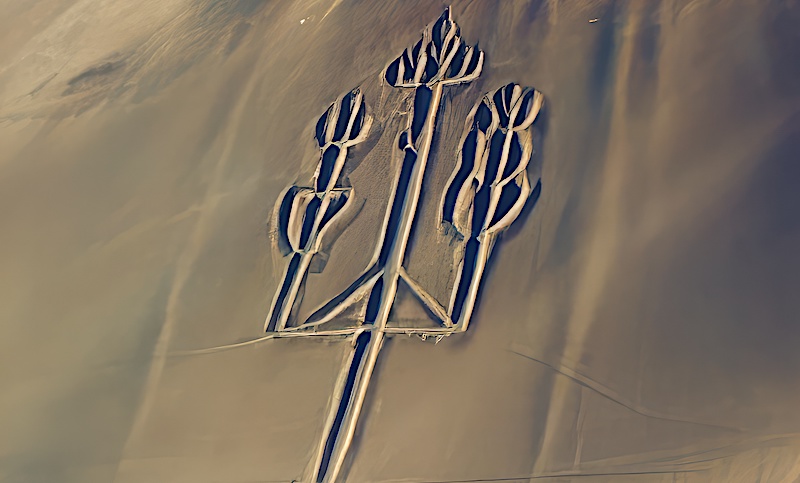
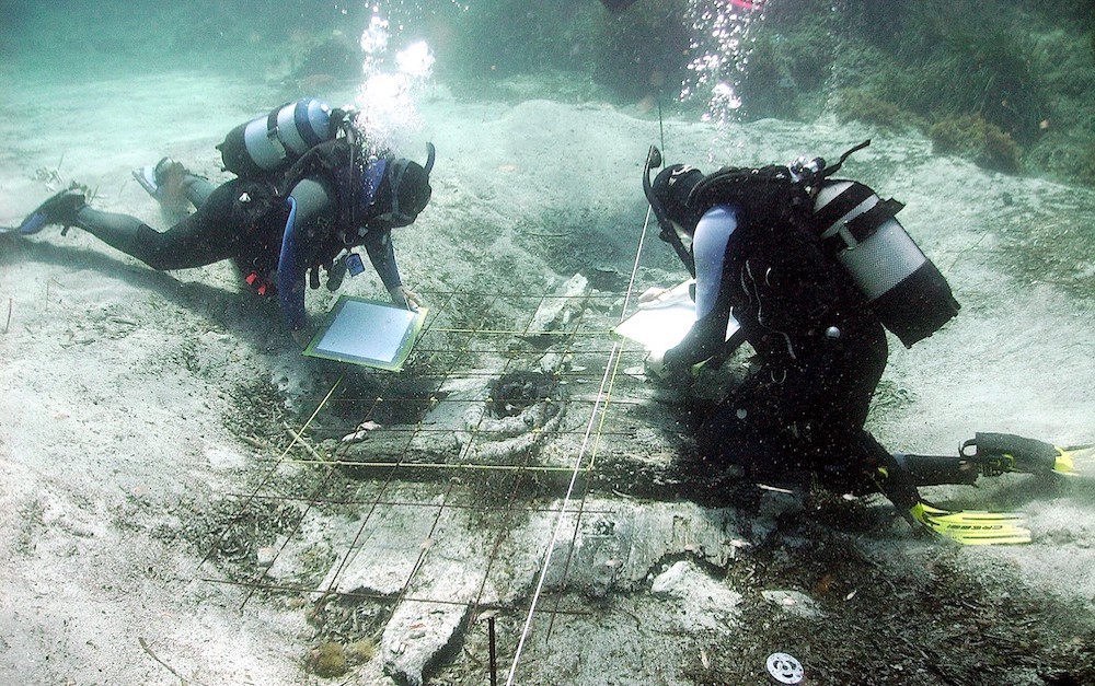
I am pleased to announce that Pi Rambla Heritage Foundation has planned several projects in Peru for the coming years: 1) The CANDELABRO OF PARACAS PROJECT, an effort of archaeological restoration to return the enigmatic geoglyph in Paracas Bay to its original state and to interpret its meaning. 2) The PARACAS MARITIME EXPLORATION PROJECT, consisting of conducting underwater archaeological surveys in various areas of the Paracas Reserve. Its goal is to locate archaeological remains of ancient maritime activities that occurred in this important region of the Pacific Ocean, including evidence of transpacific landings dating back more than 3,000 years. 3) The NAZCA PROJECT, a geophysical investigation of the Nazca Lines and drawings, and a continuation of the research by Maria Reiche and Maria Scholten d'Ebneth. Thank you very much
MARITIME EXPLORATION
PERUVIAN PACIFIC OCEAN
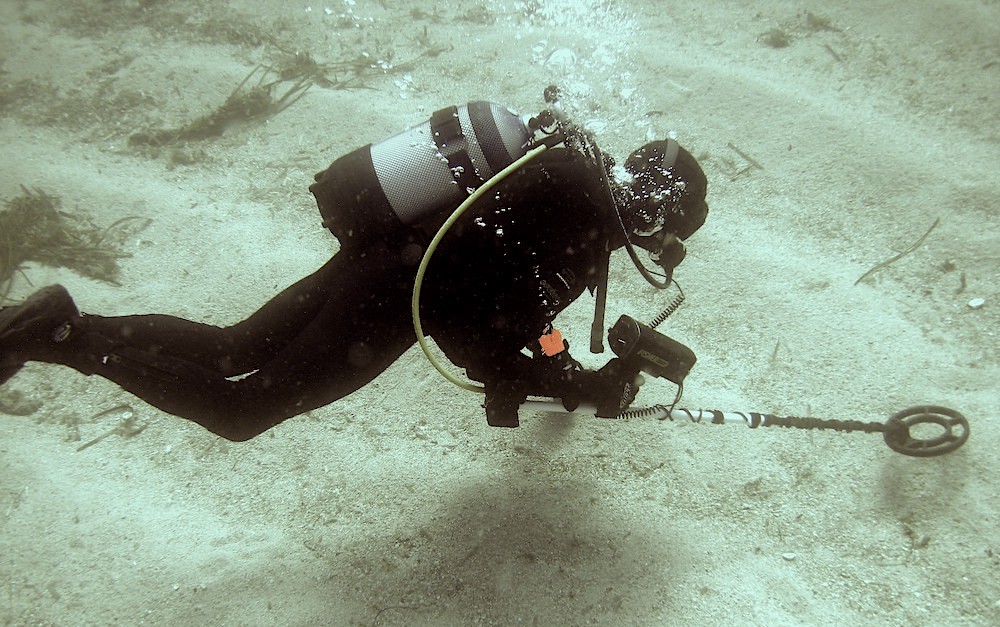
Archaeological works on the Peruvian Pacific Ocean coast regarding the investigation of ancient trans-Pacific Asian voyages
Anselm Pi Rambla and his team will carry out underwater surveys in different areas of the Peruvian coast in order to locate archaeological remains of the millenary maritime activity in this important region of the Pacific Ocean. We have significant evidence that suggests that this western coast of South America was an area of significant trans-Pacific landings over 3000 years ago
New Project 2025-2026

NAZCA PROJECT
THE LABYRINTH OF THE WORLD
Geophysical Research
Archaeological work and analysis in state-of-the-art geophysical remote sensing in the Nazca lines
New Project 2026-2027
ADVANCEMENT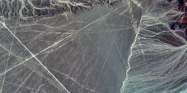
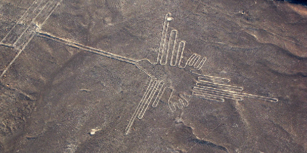
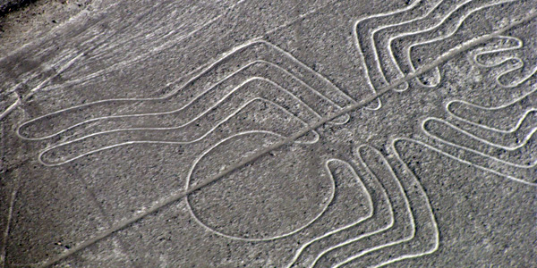
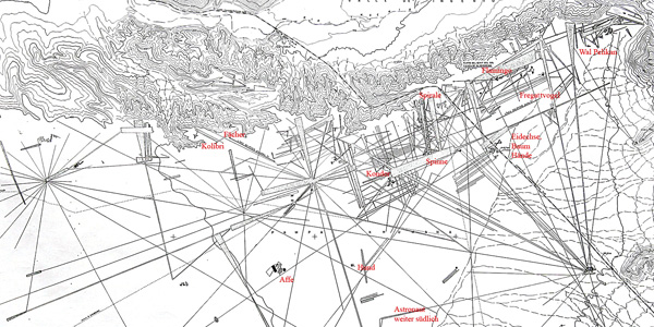
Geophysical Research
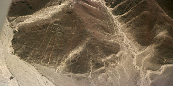
Archaeological and geophysical works on the Nazca lines


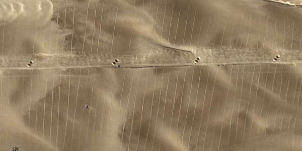
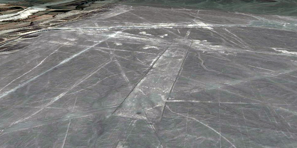
When flying over Nazca, it is enough to observe the immensity of this desert to where these lines are observable to realize that their whole is chaotic; Some end up abruptly, others intersect in any direction, some are lost in front of the coast towards the Pacific Ocean, there are others that are directed towards the Andean mountain range, being impossible to determine that its design and utility are only astronomical. All of this without forgetting that many of the lines appear on other older, barely visible, that point to different directions. We have done many reconnaissance flights in an area from Paracas to beyond Nazca and we have observed many lines that still today have not been discovered or analyzed by official science. The scarce rains of this area, one of the driest on the planet, and the lack of obstacles to the wind, which releases its sand about a hundred kilometers to the north, make the drawings are maintained almost indefinitely. Observing this true chaos one realizes that the different interpretations that have been made on Nazca are far from the reality of what they are and for which they were constructed. We are convinced and this is where our work points out that it is necessary and essential to combine many more research disciplines such as studies of history, ancient symbology, geological studies, archaeastronomic and the latest advances in underground remote sensing systems among others.
Maria Scholten d´Ebneth
Nazca Testimony of a High Culture
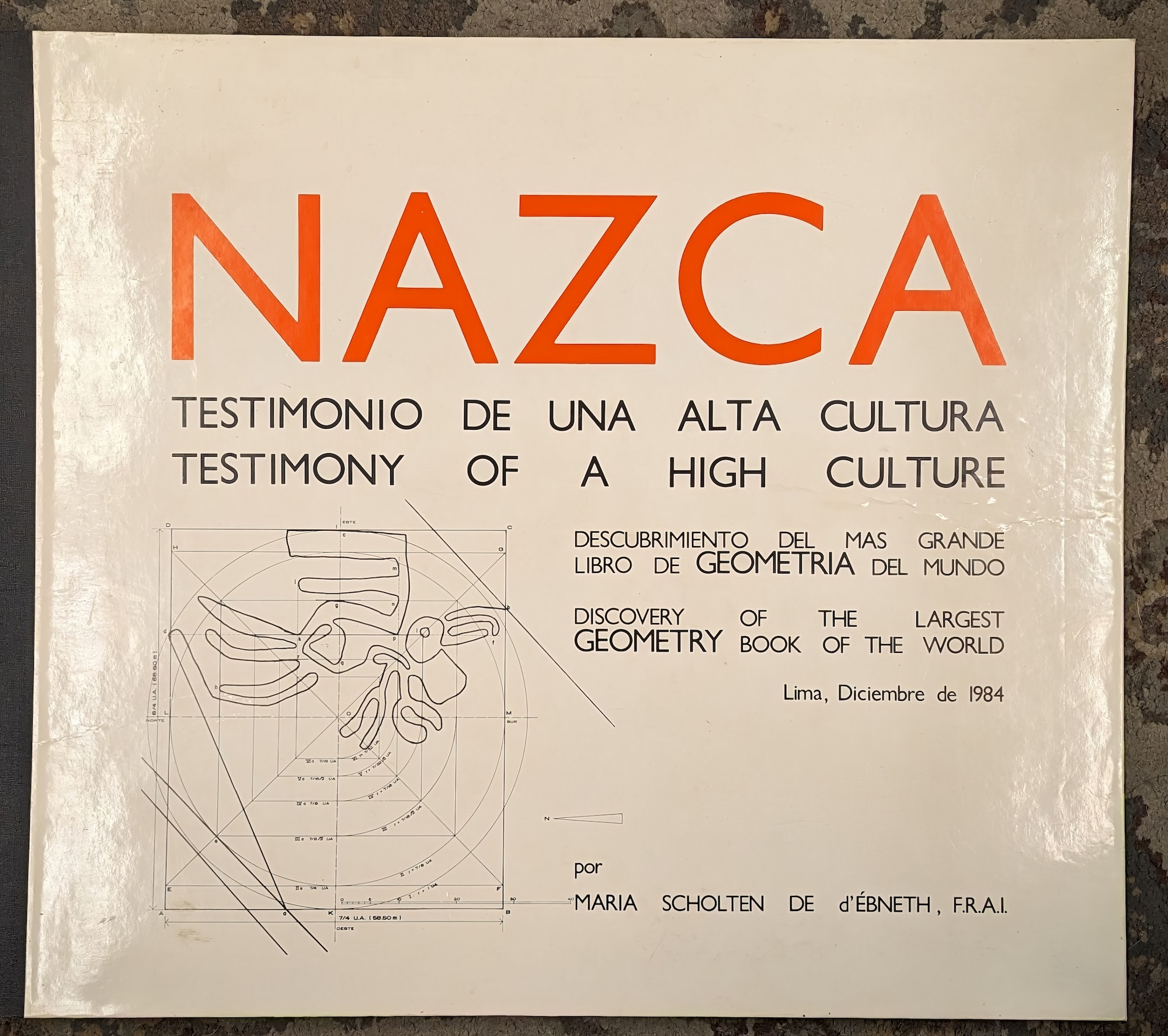
With its firm, single-line stroke, without aberrations, yet with unmatched artistic fluidity and an astonishing resemblance to the natural form of the animal, human, or plant they represent, seeking an explanation for its design in the field of Geometry at first glance seems almost impossible. However, the designers and executors of the figures of the Nazca Plains masterfully conform to the system of the AMERICAN UNIT and its concatenations. The crucial DISCOVERY, which has given me great happiness, because it constitutes another indicator of the fabulous knowledge and great ingenuity of the artist-mathematicians of the ancient Peruvian culture, is the fact that ALL THE ANALYZED FIGURES ARE ORIENTED TO THE FOUR CARDINAL POINTS. In such a way that they can be fitted into lines that follow these four directions, the resulting geometric figures, rectangles or squares, have length and width according to the measurements and relationships of the AMERICAN SYSTEM OF MEASUREMENTS AND RELATIONSHIPS under consideration. The designs of the figures develop from these rectangles and squares according to the already described method of INCREASE AND REDUCTION.
Nazca Plate
Atacama Trench Archaeological remains
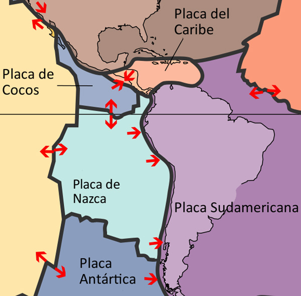
One of the investigations that we think is most important to consider is why the Nazca Lines are located opposite the critical point of suction in the Atacama Trench due to the push of the Nazca Plate in the Pacific against the South American Plate causing the Andes to rise increasingly.
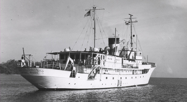
When the earth's crust collapses at one of its inflection points, ancient archaeological remains of the area have been thrown into the ocean abyss. As a notable example of this we can cite the photographs of the "Milne-Edwards" pit taken by Dr. Menzies, of Duke University, from the oceanographic vessel Anton Bruun in 1965, off the coast of Peru.
The sonar recordings made in this area indicated very strange configurations in the ocean floor, which was apparently a muddy surface. The photographs taken at a depth of 2000 meters showed what looked like huge pillars and walls, some covered with calligraphic signs.
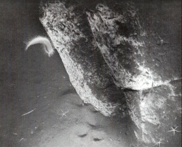
When they tried to take other photographs they noticed that although the position of the special chamber was modified by the submarine currents, other plates of rocks with artificial forms were obtained that lay on the sides, and some of them in piles, as if they had rolled one on top other. This happened at a time when many archaeological remains sank to a depth of more than 1500 meters at the bottom of the sea. Although this incident shows one of the deepest depths of the ocean in which ruins have been found, it is probable that future underwater explorations, carried out at the same or similar depths, will provide definite evidence, in the relatively near future, of the existence of civilizations Whose remains lie now at the depth of the world's oceans.
